 Hits
Hits

GEOG UK terrain heights

- GEOG-Terrain modelling software
post 07 Feb 2025
Grid Software Links →
Azimuthal Projections Info
i was interested in calculating the distance and bearing between amateur radio stations. circle distance and bearing. ultimately, this interest led to a web form for producing azimuthal maps
Armham Program Map
Amateur radio maps dos and windows program which contains maps of continents and countries
Azimuth
The AZIMUTH program plots a world map in either azimuth
31
i was interested in calculating the distance and bearing between amateur radio stations. circle distance and bearing. ultimately, this interest led to a web form for producing azimuthal maps
Amateur radio maps dos and windows program which contains maps of continents and countries
The AZIMUTH program plots a world map in either azimuth

Ferrite Shop Ferrite-shop on-line shop, cable clamps,toroids, cable cores, technic,ferrite material choice
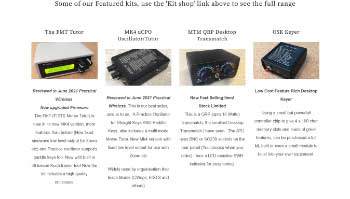
Amateur radio kits by Kanga US

Pcs Electronics RF power amplifiers-pallets archives-ABC of FM AM DAB+ DRM radio transmitters